Information window - press J or ? to to open, ESC to close
Image Size * 0 1 5 10 12 buttons on top of page represent photo heights of:40px 133px 500px 1000px and 1200px * There are 3 modes of display ( Z ) for a single photo:1)normal, 2)background stretch, and 3)height or width stretch Navigation - single photo * Click mouse in left/right part of the screen* Use +/- 5 10 20 50 buttons to skip forward/backward * Use right/left keyboard arrow keys * Use keyboard keys eg N =New Photos, A =Arizona |
Settings window - ESC to close
| Coming soon |
|
|

Navigator
 1.* Photos *
 |
2.Best/Pano/Minis |
3.My Adventures |
4.Travels |
5.Questions/Answers |
6.Prog |
7.Maps |
8.CoolGeographic
1.Arizona |
2.Colorado |
3.Utah |
4.California |
5.Nevada |
6.New Mexico |
7.Wyoming |
8.Montana |
9.Ontario |
10.Greece |
11.SlovakiaColorado
ALL |
1.Crystal Lake |
2.Red Mountain Pass |
3.Mount Sneffels |
4.San Juan Mountains |
5.Last Dollar Road |
6.Owl Creek Pass |
7.Ouray |
8.Silverton |
9.Molas Pass |
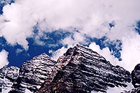
10.Maroon Bells |
11.Mount Sopris |
12.McClure Pass |
13.Crested Butte |
14.Kebler Pass |
15.Ohio Pass |
16.Blue Mesa |
17.Independence Pass |
18.Aspen |
19.Twin Lakes |
20.La Plata Peak |
21.Mt Elbert |
22.Mt Massive |
23.Mt Yale |
24.Mt Princeton |
25.Leadville |
26.Fremont Pass |
27.Eisenhower Tunnel |
28.Silverthorne & Frisco |
29.Loveland Pass |
30.Mt Evans |
31.Mt Bierstadt |
32.Long's Peak |
33.Rocky Mountain National Park |
34.Boulder |
35.Clear Creek by Golden |
36.Miner's Candle |
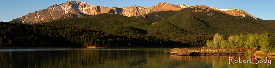
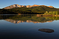
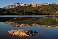
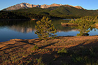
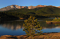
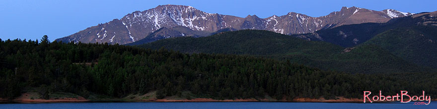
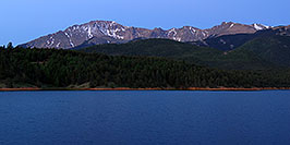
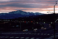
37.Pike's Peak |
38.Garden of the Gods |
39.Rampart Range Rd |
40.Sedalia |
41.Wilkerson Pass |
42.Grand Junction |
43.Mesa Verde |
44.Durango |
45.Wolf Creek Pass |
46.Blanca Peak |
47.Del Norte to Trinidad |
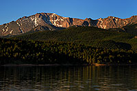
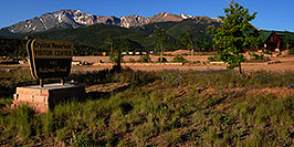
48.Great Sand DunesPike's Peakelev: 14,110 ft Front Range 31st tallest fourteener |
|
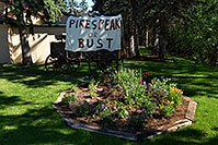
Named after Zebulon Pike who first documented the mountain while climbing it in 1806. Hiking: road to the top The most visited mountain in North America (second in the world after Japan's Mount Fuji ). Pikes Peak HighwayFamous due to its far visibility up to 130miles, Pikes Peak was a symbol of Colorado's Gold Rush in 1859 with a slogan "Pikes Peak or Bust". |
 |
 |
 |
 |
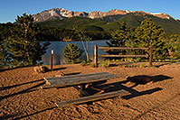 |
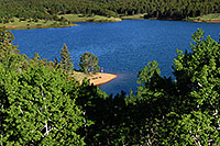
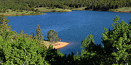
...Crystal Reservoir
 |
 |
 |
 |
 |
 |
 |
 |
 |
 |
 |
 |
 |
18
0
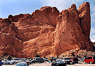 |
| Colorado > Garden of the Gods |
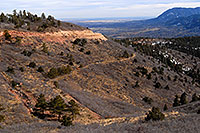 |
| Colorado > Rampart Range Rd |
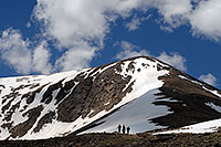 |
| Colorado > Mt Elbert |
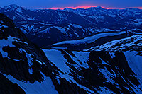 |
| Colorado > Mt Evans |
 |
| Cities > Colorado Springs |
 |
| Special > Mountain Peaks |
Notes:
|
• In 1891 US Board on Geographic Names officially removed apostrophes from geographic names, and "Pike's Peak" became "Pikes Peak".
• Pikes Peak Highway -
.colorado.pikes-peak
|